St Albans, Christchurch | Google Maps
Website: https://goo.gl/maps/KNFzgFcCsF27sgVC9
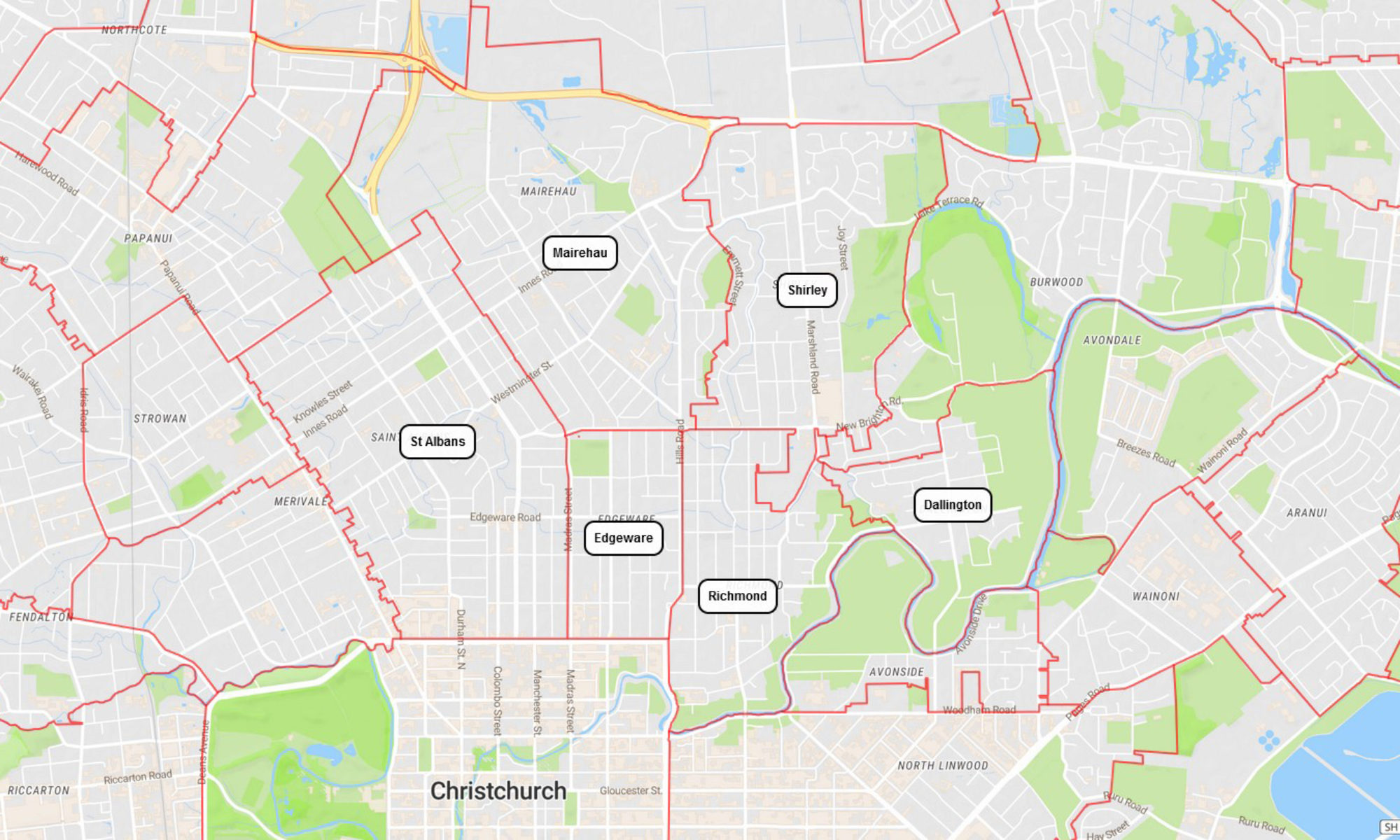
Wards, Councillors and Community Boards Map | Christchurch City Council
Website: https://ccc.govt.nz/the-council/how-the-council-works/elected-members/representation/#15/-43.5026/172.6328
View a Planning Map | Christchurch District Plan
Website: https://districtplan.ccc.govt.nz/PropertySearch/PropertySearchContainer.html?feature=DistrictPlanIndex&featureId=25
Search for a Property | Christchurch District Plan
Website: https://districtplan.ccc.govt.nz/PropertySearch/PropertySearchContainer.html
St Albans North | Stats NZ 2018 Place Summaries
Website: https://www.stats.govt.nz/tools/2018-census-place-summaries/st-albans-north
St Albans North | StatsNZ Geographic Boundary Map
Website: https://arcg.is/jq0e
St Albans East | Stats NZ 2018 Place Summaries
Website: https://www.stats.govt.nz/tools/2018-census-place-summaries/st-albans-east
St Albans East | StatsNZ Geographic Boundary Map
Website: https://arcg.is/DGeOv0
St Albans West | Stats NZ 2018 Place Summaries
Website: https://www.stats.govt.nz/tools/2018-census-place-summaries/st-albans-west
St Albans West | StatsNZ Geographic Boundary Map
Website: https://arcg.is/0TzeCG
Rutland | Stats NZ 2018 Place Summaries
Website: https://www.stats.govt.nz/tools/2018-census-place-summaries/rutland
Rutland | StatsNZ Geographic Boundary Map
Website: https://arcg.is/0qWDzH
Malvern | Stats NZ 2018 Place Summaries
Website: https://www.stats.govt.nz/tools/2018-census-place-summaries/malvern
Malvern | StatsNZ Geographic Boundary Map
Website: https://arcg.is/15aunf